
Carlin, Nevada
- Wind
- Calm
- Humidity
- 86%
- Dew point
- 21°
- Visibility
- 10+ mi
- Pressure
- 30.03 in
- Sunrise / set
- 6:37 AM / 4:22 PM
Observed 9:00 PM PT at Elko, Elko Regional Airport
What to expect tonight
- Tonight: Patchy Fog, low around 15°. Below freezing.
- Saturday: patchy fog then mostly sunny, high near 37°.
- Dry for the next 12 hours.
- Light winds, gusts under 10 mph.
- Air quality: Good (AQI 11).
The forecaster's wording
Tonight: Patchy fog after 11pm. Mostly clear, with a low around 15. Southwest wind around 0 mph.
Saturday: Patchy fog before 10am. Mostly sunny, with a high near 37. Southeast wind around 0 mph.
Next 48 hours
Updated 9:26 PM PTWarmest 39° Sun 1 PM; coldest 16° Sat 7 AM; best chance of rain 10% Sun 4 PM; strongest gust 3 mph Sat 7 PM.
7-day forecast
Updated 9:26 PM PTTonightNov 20Patchy Fog1%15°
Tonight: Patchy fog after 11pm. Mostly clear, with a low around 15. Southwest wind around 0 mph.
SaturdayNov 21Patchy Fog then Mostly Sunny0%21°37°
Saturday: Patchy fog before 10am. Mostly sunny, with a high near 37. Southeast wind around 0 mph.
Saturday Night: Cloudy, with a low around 21. East southeast wind around 0 mph.
SundayNov 22Mostly Cloudy24%22°39°
Sunday: Mostly cloudy, with a high near 39. Northeast wind around 0 mph.
Sunday Night: Isolated snow showers between 10pm and 4am, then areas of fog. Mostly cloudy, with a low around 22. Northeast wind around 0 mph. New rainfall amounts less than a tenth of an inch possible.
MondayNov 23Areas Of Fog then Mostly Cloudy14%16°37°
Monday: Areas of fog before 9am. Mostly cloudy, with a high near 37. New rainfall amounts less than a tenth of an inch possible.
Monday Night: Partly cloudy, with a low around 16.
TuesdayNov 24Partly Sunny28%24°40°
Tuesday: Partly sunny, with a high near 40.
Tuesday Night: Scattered snow showers after 10pm. Mostly cloudy, with a low around 24. Chance of precipitation is 30%.
WednesdayNov 25Scattered Snow Showers33%23°41°
Wednesday: Scattered snow showers before 10am, then scattered rain and snow showers. Mostly cloudy, with a high near 41. Chance of precipitation is 30%.
Wednesday Night: Scattered rain and snow showers. Mostly cloudy, with a low around 23. Chance of precipitation is 30%.
Thanksgiving DayNov 26Isolated Rain And Snow Showers17%24°42°
Thanksgiving Day: Isolated rain and snow showers before 4pm. Mostly sunny, with a high near 42.
Thursday Night: Partly cloudy, with a low around 24.
Tap a day for the full forecast text. Bars show each day's low-to-high range against the week.
From the Elko forecasters
Written 3:18 PM PT- Light, scattered snow showers will continue into the late afternoon and early evening across portions of northeast and east-central Nevada.
- Expect cold temperatures behind the system especially early Saturday morning.
- Active weather continues with the potential for more weather systems through the weekend as well as Tuesday through early Thanksgiving of next week.
Read the full forecast discussion
Aviation Update
KENV is AMD NOT SKED due to a comms outage.
KBAM has returned to service and comms is stable.
Isolated -SHSN will continue through the later afternoon across KEKO and KENV terminals with LCL MVFR conditions possible. Otherwise, VFR will be the dominant flight category through the next 24 hours. Occasional breezes to 20 mph are expected through Saturday afternoon and well.
The big picture
(This evening through next Thursday)
WEATHER PATTERN OVERVIEW: Current radar loop is depicting isolated to scattered snow showers across portions of northeast and east- central Nevada at this time. These light off and on snow showers will slowly dissipate later this afternoon and early evening. This is also confirmed by the latest near term progs as well. Additional accumulations of a trace to half-inch is possible. Therefore, the winter headlines are going to be canceled early. Skies are expected to clear during the latter portions of the overnight. With the recent snow cover over much of the area, low temperatures are expected to be in the single digits and teens. Some of the colder locales may even see readings near zero degrees.
All models are showing a brief break in the active weather for Saturday and Sunday. Skies are expected to be partly cloudy with peeks of sun here and there. Afternoon high temperatures will be below normal for this time of year with many sites struggling to get over the 40 degree mark. Winds are expected to remain light with gusts to 15 mph. An upper trough will be moving towards the Pacific Northwest states Saturday night and Sunday. This will re- introduce light snow showers across the western and northern Humboldt county. Overnight lows will be in the teens and 20s. The main trough will wobble around the Pacific Northwest on Sunday but energy will round the base of the trough and push across north-central Nevada on Sunday. Highs will again remain on the cool side with readings in the 30s to maybe 40 degrees but temperatures are expected to struggle breaching the 40 degree mark. The light snow showers are expected to continue Sunday night into Monday. Storm total snow amounts are looking fairly meager at this time with up to a half-inch of accumulation by early Monday morning with the highest amounts across Humboldt county. Higher passes and summits could see up to an inch. Overnight lows will be in the teens and 20s once again. On Monday, the system eject east of the area with a shortwave ridge building on Monday. The ridge will be somewhat transitory with highs Monday again in the 30s to perhaps the low 40s. Winds will remain light. The ridge axis will be passing overhead and then east Monday night into Tuesday with the next weather system coming ashore late Tuesday into Wednesday. Overnight lows Monday night will be in the teens and 20s with afternoon high temperatures in the 30s and 40s on Tuesday. Some afternoon breezes to 20 mph are possible in central Nevada.
Tuesday night through roughly Thanksgiving. This next system is coming in a little warmer than previous forecasts. However, confidence remains low in this particular system and will need to continue watching for any deviation in movement. Highs during the Tuesday through Friday are looking like the 30s and 40s Wednesday, rising into the 40s to low 50s Thursday and Friday. Overnight lows will be in the teens and 20s Tuesday night, rising into the 20s on Wednesday and Thursday night.
FORECAST CONFIDENCE & DEVIATIONS: High confidence exists in the coldest temperatures of the period taking place Saturday and Sunday mornings. Moderate confidence exists in the continuation of an active pattern into next week. However, confidence is low so far in precip type, timing, and amounts at this time.
Aviation
Isolated -SHSN will continue through the later afternoon across KEKO and KENV terminals with LCL MVFR conditions possible. Otherwise, VFR will be the dominant flight category through the next 24 hours. Occasional breezes to 20 mph are expected through Saturday afternoon and well.
KBAM remains AMD NOT SKED due to a station upgrade. KENV is also AMD NOT SKED due to a comms outage.
Written by National Weather Service meteorologists in Elko for all of northern and central Nevada. Lightly reformatted, not edited.
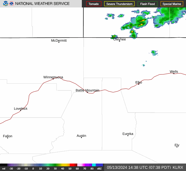
Radar & satellite

Sky, air & almanac
Sun & daylight
- First light
- 6:07 AM
- Sunrise
- 6:37 AM
- Solar noon
- 11:29 AM
- Sunset
- 4:22 PM
- Last light
- 4:52 PM
Moon & night sky
- Moonrise
- 1:49 PM
- Moonset
- 2:02 AM
- Full moon
- Tue Nov 24
- New moon
- Tue Dec 8
- Truly dark tonight
- 11 hr 5 min
- Dark with no moon
- 1 hr 50 min
UV & air quality
Elko's state monitor reports coarse dust (PM10). There is no official fine-smoke (PM2.5) monitor in town, so during wildfires check the smoke page.
Wildfire & smokeFire weather
No red flag warning or fire weather watch
- Driest air, next 24 hr
- 56% humidity, Sat 2 PM
- Strongest gust, next 24 hr
- 3 mph, Sat 7 PM
This date in Elko weather
- Normal high / low
- 47° / 21°
- Yesterday
- 44° / 32°, 0.23" precip
- Record high
- 78° in 1894
- Record low
- -6° in 1977
- Coldest high
- 22° in 1944
- Warmest low
- 42° in 2012
- Wettest
- 0.60" in 1900
- Snowiest
- 6" in 1900
Elko Regional Airport, records since 1891. Normals are 1991–2020.
Elko airport conditionsRain & snow totals
- November so far
- 1.12" (normal 0.55")
- Snowfall since Oct 1
- 4.5"
- Forecast, next 7 days
- 0.01"
Elko Regional Airport, through Nov 19. The water year runs Oct 1 to Sep 30. Forecast amount is for this town.
Mountains, snow & water
Ruby Mountains high country
Updated 9:08 PM PTLamoille Canyon, near the Lamoille Upper snow site, about 9,000 ft
- TonightPartly Cloudy · WNW 10 mph14°
- SaturdayMostly Sunny · WSW 5 to 10 mph27°
- Saturday NightMostly Cloudy · SSW 10 to 15 mph17°
- SundayMostly Cloudy then Isolated Snow Showers · SSW 5 to 10 mph30°
Up high it is often 15 to 25 degrees colder and much windier than in town. Weather can turn fast.
Outdoors guideMountain snowpack
Updated 9:08 PM PT- Green Mountain8,180 ft · 38 mi away15"snow on the ground2.1"300% of normal
- Lamoille #38,040 ft · 38 mi away8"snow on the ground1.6"229% of normal
- Lamoille Upper8,990 ft · 39 mi away20"snow on the ground4.3"water content
At the closest site, snow usually starts to stick around Nov 17 and peaks near Mar 22 with about 15.6" of water.
USDA SNOTEL. Water content is how much water the snow would melt into; it feeds the Humboldt in spring.
All snow sites & riversRivers & creeks
Updated 9:08 PM PT- Humboldt River near ElkoTypical today: 29 cfs8.1cubic ft/secLower than usual
- Humboldt River near CarlinTypical today: 46 cfs16.7cubic ft/secMuch lower than usual
- Lamoille Creek near LamoilleTypical today: 5.1 cfs4.3cubic ft/secNormal for the date
USGS stream gauges, provisional data. "Usual" is the middle half of all past readings for this date.
Rivers & snowpack pageGetting around & getting out
Roads right now
Updated 9:25 PM PTClosures or stopped traffic reported
- I-80Closed
- US-93 NorthAdverse driving conditions
- US-93 SouthWind alert: vehicles over 9 ft use caution
- SR-225no reported restrictions
- SR-227no reported restrictions
- SR-228no reported restrictions
From NV 511. Closures, chain controls and crashes for I-80, US-93 and the state routes.
Road conditions, map & camerasNV 511Planning a day outside
- Tomorrow morning
- First light 6:08 AM, sunrise 6:38 AM
- High country tonight
- Low 14°, wind 10 mph
- Moon tonight
- 85% lit
First and last light are civil twilight. For legal shooting hours and season dates, go by the Nevada Department of Wildlife regulations.
Outdoors guideNDOWRecent Earthquakes
Magnitude 2.5+ within 155 miles of Elko, past 7 days — live from the USGS.
Nothing above M2.5 within 155 miles this week — the Great Basin is napping.
Data: U.S. Geological Survey earthquake feed (public domain).