
Winter Weather AdvisoryUntil Fri Nov 20, 4:00 PM PTRead
Winter Weather Advisory issued November 19 at 7:12PM PST until November 20 at 4:00PM PST by NWS Elko NV
* WHAT...Snow expected. Total snow accumulations for the following locations include: Humboldt, northern Lander/Eureka, southwest and south-central Elko counties: 1 to 3 inches; northern Elko, White Pine, and southern Lander/Eureka counties: 2 to 5 inches; higher passes and summits for all aforementioned locations above: 3 to 7 inches. Winds in central Nevada will be 20 to 30 mph with gusts to 40 mph.
* WHERE...Portions of eastern, north central, northeast, and northwest Nevada.
* WHEN...Until 4 PM PST Friday.
* IMPACTS...Travel could be very difficult. Strong winds in central Nevada could cause blowing and drifting snow. The hazardous conditions will impact the Thursday morning and evening commutes.
What to do: Slow down and use caution while traveling. The latest road conditions for the state you are calling from can be obtained by calling 5 1 1.
NWS Elko NV · Humboldt County; Northern Elko County; White Pine County; Northern Lander County and Northern Eureka County; Southern Lander County and Southern Eureka County; Southwest Elko County; South Central Elko County
Elko, Nevada
- Wind
- SSW 5 mph
- Humidity
- 100%
- Dew point
- 32°
- Visibility
- 1.5 mi
- Pressure
- 29.69 in
- Sunrise / set
- 6:35 AM / 4:21 PM
Observed 6:56 PM PT at Elko, Elko Regional Airport
What to expect tonight
- Winter Weather Advisory until Fri 4:00 PM. Details below.
- Tonight: Rain And Snow Showers, low around 25°. Below freezing.
- Friday: chance snow showers, high near 36°.
- Rain and snow likely (up to 97%), starting around 7 PM. Snow could add up to about 1 inches in the next 24 hours.
- Light winds, gusts under 24 mph.
- Air quality: Good (AQI 5).
The forecaster's wording
Tonight: Rain and snow showers. Cloudy, with a low around 25. Southwest wind 10 to 15 mph. Chance of precipitation is 100%. New snow accumulation of 1 to 2 inches possible.
Friday: A chance of snow showers before 4pm. Mostly cloudy, with a high near 36. West southwest wind 10 to 15 mph, with gusts as high as 30 mph. Chance of precipitation is 60%. New snow accumulation of less than one inch possible.
Next 48 hours
Updated 7:48 PM PTWarmest 36° Thu 7 PM; coldest 15° Sat 7 AM; best chance of rain and snow 97% Thu 7 PM; strongest gust 26 mph Fri 10 AM; about 0.22" of precipitation (1.2" of snow).
7-day forecast
Updated 7:48 PM PTTonightNov 19Rain And Snow Showers100%25°
Tonight: Rain and snow showers. Cloudy, with a low around 25. Southwest wind 10 to 15 mph. Chance of precipitation is 100%. New snow accumulation of 1 to 2 inches possible.
FridayNov 20Chance Snow Showers63%14°36°
Friday: A chance of snow showers before 4pm. Mostly cloudy, with a high near 36. West southwest wind 10 to 15 mph, with gusts as high as 30 mph. Chance of precipitation is 60%. New snow accumulation of less than one inch possible.
Friday Night: Mostly cloudy, with a low around 14. Southwest wind 5 to 10 mph.
SaturdayNov 21Mostly Sunny1%16°34°
Saturday: Mostly sunny, with a high near 34. South wind 0 to 5 mph.
Saturday Night: Mostly cloudy, with a low around 16. East wind 0 to 5 mph.
SundayNov 22Mostly Cloudy then Scattered Snow Showers31%17°37°
Sunday: Scattered snow showers after 4pm. Mostly cloudy, with a high near 37. Chance of precipitation is 30%.
Sunday Night: Scattered snow showers before 4am. Mostly cloudy, with a low around 17. Chance of precipitation is 30%.
MondayNov 23Partly Sunny9%12°36°
Monday: Partly sunny, with a high near 36.
Monday Night: Mostly cloudy, with a low around 12.
TuesdayNov 24Mostly Cloudy36%21°37°
Tuesday: Mostly cloudy, with a high near 37.
Tuesday Night: Scattered snow showers after 10pm. Mostly cloudy, with a low around 21. Chance of precipitation is 40%.
WednesdayNov 25Scattered Snow Showers36%21°40°
Wednesday: Scattered snow showers before 1pm, then scattered rain and snow showers. Mostly cloudy, with a high near 40. Chance of precipitation is 40%.
Wednesday Night: Scattered rain and snow showers before 4am. Mostly cloudy, with a low around 21.
Tap a day for the full forecast text. Bars show each day's low-to-high range against the week.
From the Elko forecasters
Written 12:22 PM PT- A weather system continues bringing periods of more snow with some rain across Nevada Thursday afternoon, with a final round of showers Friday.
- Expect cold temperatures with the lowest this week on Saturday night.
- Active weather continues with the potential for more weather systems next week
Read the full forecast discussion
The big picture
(This evening through next Wednesday)
Weather pattern overview:
The first of several pieces of energy has moved through NV bringing snow across much of the area as temperatures came in below forecast last night. Overall forecast is still on track as the next piece of energy is making its way over the Sierras and into western Nevada. This afternoon snow or a rain snow mix is taking place along I 80 and US 95 corridors as eastern Nevada enjoyed a brief pause in precipitation this morning. Transition to all snow will again take place this evening quickly after sunset, as the loss of any heating helps amplify the wet-bulb cooling effect. Accumulation totals for this part will be likely be similar to Wednesday nights event for most with the lower elevation valleys seeing between 0.5 up to 3, higher elevation valleys could see between 2 to 4 of new snow. For passes and road summits snow 3 to 5 of new snowfall, with the mountain ranges seeing all snow with this event with totals between 8 to 18 plus possible. Winds are still going to be elevated through the rest of the evening, as gusty S to SW winds will be possible through Friday morning. Especially for central Nevada as N Nye, White Pine, southern Lander, and S Eureka Counties could see South to Southwest winds of 20 to 30 MPH with gusts up to 40 MPH possible. Further north winds arent expected to be as strong, but will still be breezy at 15 to 25 MPH with gust up to 35 MPH possible. The combination of winds and snowfall will bring adverse to hazardous driving conditions for area highways Thursday evening through Friday. Winter headlines continue for area with a Winter Storm Warning for the Ruby Mountains, and a winter Weather Advisory for Parts of Elko, Eureka, Lander, Humboldt, and White Pine Counties through Friday evening. Friday a cold front will push through the region which will shift wind to the NW with breezy conditions continuing with speeds of 10 to 20 MPH with gusts up the 30 MPH possible. Also for Friday the main upper trough will pass overhead, and with that will be the possibility for isolated to scattered convective snow showers and snow squalls which would offer less overall precipitation coverage, but give enhanced precipitation rates. These event could bring a boost to local snow totals. Central Nevada will see the greatest chances for these features as instability, what little there is will be concentrated along the US 50 corridor. Temperatures for this event will likely depend on precipitation mechanics as areas with active precipitation will be cooler due to wet bulb effects, only to rebound as breaks in precipitation occur. Overall highs will range in the low 30s to low 40s with lows in the upper 20s through Saturday morning. With the exit of this upper trough, Saturday will see a brief break as a short wave ridge passes through. This break however will be short lived as another upper level trough will start to move through Sunday afternoon through Monday evening. This system looks to be weaker and faster than Thursdays storm, but could have the potential to bring isolated rain/snow showers with accumulations of 0.5 to 2 of snow for the passes and range summits, and up to 0.10 of rain for the valleys. Tuesday will bring another quick break in the action before another system will try to move through for next Wednesday with more chances for rain/snow showers. Temperature for the rest of the week look to remain near to or below normal as highs look to range in the upper 30s to upper 40s with lows in the upper teens to 20s for overnight lows.
Forecast confidence & deviations:
There is high confidence in winter precipitation and breezy to gusty winds Today and Friday with parts of NE Nevada.
There is medium confidence for another, weaker upper level trough passage across Nevada Sunday and Monday.
There is medium confidence of a third upper trough pushing into the western US for next Wednesday.
Aviation
VFR conditions are forecast to be the primary flight conditions across Nevada through Saturday morning with south winds of 10KT to 20 KT with occasional gusts up to 35KT possible. A strong upper level storm system will continue its passage through the region with two more major rounds of precipitation affecting NV this afternoon through Friday. Today -SHRASN has been falling at KWMC and is expected to spread east with increasing coverage. Showers will continue to expand in coverage and intensity during to overnight with KEKO, KELY, KTPH, and KENV seeing VCSH to -SHSN by Friday morning, with a final round of convective snow showers Friday afternoon. Winds will shift with a cold frontal passage Friday afternoon with NW winds of 10KT to 20 KT with gusts up the 30 KT possible. While not continuous showers will bring be short term reductions in visibility at terminals, with levels falling to MVFR to even VFR levels with stronger shower bands with ceilings dropping to less than 2000 feet.
KBAM remains AMD NOT SKED due to a station upgrade.
Written by National Weather Service meteorologists in Elko for all of northern and central Nevada. Lightly reformatted, not edited.
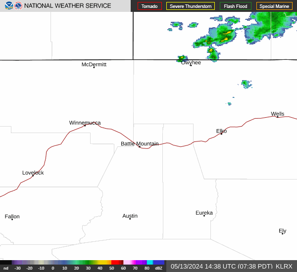
Radar & satellite

Sky, air & almanac
Sun & daylight
- First light
- 6:05 AM
- Sunrise
- 6:35 AM
- Solar noon
- 11:28 AM
- Sunset
- 4:21 PM
- Last light
- 4:51 PM
Moon & night sky
- Moonrise
- 1:25 PM
- Moonset
- 12:54 AM
- Full moon
- Tue Nov 24
- New moon
- Tue Dec 8
- Truly dark tonight
- 11 hr 5 min
- Dark with no moon
- 3 hr 0 min
UV & air quality
Elko's state monitor reports coarse dust (PM10). There is no official fine-smoke (PM2.5) monitor in town, so during wildfires check the smoke page.
Wildfire & smokeFire weather
No red flag warning or fire weather watch
- Driest air, next 24 hr
- 65% humidity, Fri 4 PM
- Strongest gust, next 24 hr
- 26 mph, Fri 10 AM
This date in Elko weather
- Normal high / low
- 48° / 21°
- Yesterday
- 39° / 25°, 0.20" precip
- Record high
- 71° in 1894
- Record low
- -10° in 1930
- Coldest high
- 18° in 1944
- Warmest low
- 44° in 1920
- Wettest
- 0.69" in 1990
- Snowiest
- 4.3" in 1983
Elko Regional Airport, records since 1891. Normals are 1991–2020.
Elko airport conditionsRain & snow totals
- November so far
- 0.89" (normal 0.52")
- Snowfall since Oct 1
- 3"
- Forecast, next 7 days
- 0.22", 1.2" snow
Elko Regional Airport, through Nov 18. The water year runs Oct 1 to Sep 30. Forecast amount is for this town.
Mountains, snow & water
Ruby Mountains high country
Updated 7:48 PM PTLamoille Canyon, near the Lamoille Upper snow site, about 9,000 ft
- TonightSnow Showers · WSW 20 to 25 mph20°
- FridaySnow Showers · W 15 to 25 mph24°
- Friday NightPartly Cloudy · W 10 to 15 mph10°
- SaturdayMostly Sunny · SSW 5 to 10 mph27°
Up high it is often 15 to 25 degrees colder and much windier than in town. Weather can turn fast.
Outdoors guideRivers & creeks
Updated 7:48 PM PT- Humboldt River near ElkoTypical today: 27 cfs8.1cubic ft/secLower than usual
- Humboldt River near CarlinTypical today: 45 cfs16.7cubic ft/secMuch lower than usual
- Lamoille Creek near LamoilleTypical today: 5.2 cfs4.5cubic ft/secNormal for the date
USGS stream gauges, provisional data. "Usual" is the middle half of all past readings for this date.
Rivers & snowpack pageGetting around & getting out
Roads right now
Updated 7:45 PM PTClosures or stopped traffic reported
- I-80Closed
- US-93 Northno reported restrictions
- US-93 SouthAdverse driving conditions
- SR-225Adverse driving conditions
- SR-227Adverse driving conditions
- SR-228Adverse driving conditions
From NV 511. Closures, chain controls and crashes for I-80, US-93 and the state routes.
Road conditions, map & camerasNV 511Planning a day outside
- Tomorrow morning
- First light 6:06 AM, sunrise 6:36 AM
- High country tonight
- Low 20°, wind 20 to 25 mph
- Moon tonight
- 77% lit
First and last light are civil twilight. For legal shooting hours and season dates, go by the Nevada Department of Wildlife regulations.
Outdoors guideNDOWRecent Earthquakes
Magnitude 2.5+ within 155 miles of Elko, past 7 days — live from the USGS.
Data: U.S. Geological Survey earthquake feed (public domain).