
Elko, Nevada
- Wind
- ENE 3 mph
- Humidity
- 86%
- Dew point
- 23°
- Visibility
- 10+ mi
- Pressure
- 30.04 in
- Sunrise / set
- 6:37 AM / 4:20 PM
Observed 1:30 AM PT at Elko, Elko Regional Airport
What to expect tonight
- Tonight: Partly Cloudy, low around 17°. Below freezing.
- Saturday: mostly sunny, high near 36°.
- Dry for the next 12 hours.
- Light winds, gusts under 10 mph.
- Air quality: Good (AQI 10).
The forecaster's wording
Overnight: Partly cloudy, with a low around 17. Southwest wind around 5 mph.
Saturday: Mostly sunny, with a high near 36. South southwest wind 0 to 5 mph.
Next 48 hours
Updated 1:06 AM PTWarmest 39° Sun 3 PM; coldest 17° Sat 6 AM; best chance of rain and snow 16% Sun 10 PM; strongest gust 7 mph Sat 12 PM; about 0.02" of precipitation (0.1" of snow).
7-day forecast
Updated 1:06 AM PTTonightNov 21Partly Cloudy0%17°
Overnight: Partly cloudy, with a low around 17. Southwest wind around 5 mph.
SaturdayNov 21Mostly Sunny0%21°36°
Saturday: Mostly sunny, with a high near 36. South southwest wind 0 to 5 mph.
Saturday Night: Mostly cloudy, with a low around 21. Northeast wind 0 to 5 mph.
SundayNov 22Mostly Cloudy16%23°39°
Sunday: Mostly cloudy, with a high near 39. East northeast wind 0 to 5 mph.
Sunday Night: Isolated snow showers between 10pm and 4am. Mostly cloudy, with a low around 23. East wind 0 to 5 mph. New snow accumulation of less than half an inch possible.
MondayNov 23Partly Sunny10%16°37°
Monday: Partly sunny, with a high near 37.
Monday Night: Areas of fog between 10pm and 1am. Partly cloudy, with a low around 16.
TuesdayNov 24Partly Sunny then Isolated Snow Showers21%24°39°
Tuesday: Isolated snow showers after 4pm. Partly sunny, with a high near 39.
Tuesday Night: Isolated snow showers. Mostly cloudy, with a low around 24.
WednesdayNov 25Scattered Rain And Snow Showers25%25°41°
Wednesday: Isolated snow showers before 10am, then scattered rain and snow showers. Partly sunny, with a high near 41. Chance of precipitation is 30%.
Wednesday Night: Scattered rain and snow showers. Mostly cloudy, with a low around 25. Chance of precipitation is 30%.
Thanksgiving DayNov 26Isolated Rain And Snow Showers23%25°43°
Thanksgiving Day: Isolated rain and snow showers before 4pm. Partly sunny, with a high near 43.
Thursday Night: Mostly cloudy, with a low around 25.
Tap a day for the full forecast text. Bars show each day's low-to-high range against the week.
From the Elko forecasters
Written 12:34 AM PT- This weekend will be cool and dry.
- A weak cold front will bring precipitation chances Sunday evening into Monday morning.
- A general warming trend is expected to persist into the next week.
Read the full forecast discussion
The big picture
(Today through next Saturday) WEATHER PATTERN OVERVIEW: Taking a quick look out the window, as far as the eye can see there is nothing. Thats right, the precipitation has cleared up, and it looks to stay that way for the remainder of the weekend. This is thanks to the one weather pattern no meteorologist in their right mind has ever claimed to get into this field for: a ridge. So, as of now, all we can do is take the advice of the Dire Straits and do the Walk of Life through this weekend, as we wait eagerly for our next wave of snow. So if you are looking for what to expect in between, you have come to the right place. Thanks to this convenient ridge, our highs will be continuing on an upward trend, with Monday being our only exception. Highs for today are currently expected to sit in the low 40s for the valleys on Saturday, and the 30s for the higher elevations. This does in fact mean that those of us who still have our winter wonderlands will be watching them disappear as Saturday progresses. And as nice as it would be to say that latent cooling effects from the melting snow will have an impact on temperatures, keeping us significantly lower, due to the ridge giving us mostly clear skies, these impacts will be severely limited. This will be the story for most of the weekend.
A brief shortwave is expected to pass through Saturday night, but due to limited moisture and instability values, precipitation is not expected to take place at this time. Instead, we will be gifted with some light cloud cover, keeping the overnight low a bit warmer than what could have been.
This pattern is expected to last us until Sunday night, when we can fill our souls with some short lived giddy once again. Remember back when I said Monday would be the exception to our warming trend? A fast moving trough is currently forecast to work its way into the CWA Sunday night, and with it, a very weak cold front, though a full on front may be strong wording in this case. It will mostly be just a short burst of cold air that brings out the best in our instability and small amounts of moisture, meaning we will have the potential for some rain and snow showers Sunday night and Monday morning. Scattered showers are expected mainly north of I-80 within our CWA. Current model guidance suggests precipitation totals will be relatively low, with expected snow amounts between 0-0.5. Monday we will see the highs in the valleys in the mid to upper 30s, with lows in the teens and 20s, but afterwards we see yet another ridge set in very quickly and the warming trend continues. By the end of the week, we may even see highs in the mid 50s, with lows above freezing. For the highs, that is only slightly above normal, but for the lows, that is substantially higher.
FORECAST CONFIDENCE & DEVIATIONS: High confidence exists in the general warming trend. Low confidence exists in precipitation type, timing, and coverage for Sunday into Monday.
Aviation
VFR conditions with no precipitation and light winds are expected through Saturday afternoon.
Written by National Weather Service meteorologists in Elko for all of northern and central Nevada. Lightly reformatted, not edited.
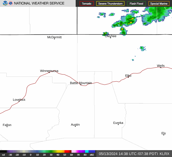
Radar & satellite

Sky, air & almanac
Sun & daylight
- First light
- 6:07 AM
- Sunrise
- 6:37 AM
- Solar noon
- 11:28 AM
- Sunset
- 4:20 PM
- Last light
- 4:50 PM
Moon & night sky
- Moonrise
- 2:13 PM
- Moonset
- 3:10 AM
- Full moon
- Tue Nov 24
- New moon
- Tue Dec 8
- Truly dark tonight
- 11 hr 5 min
- Dark with no moon
- 0 hr 40 min
UV & air quality
Elko's state monitor reports coarse dust (PM10). There is no official fine-smoke (PM2.5) monitor in town, so during wildfires check the smoke page.
Wildfire & smokeFire weather
No red flag warning or fire weather watch
- Driest air, next 24 hr
- 62% humidity, Sat 2 PM
- Strongest gust, next 24 hr
- 7 mph, Sat 12 PM
This date in Elko weather
- Normal high / low
- 47° / 21°
- Record high
- 76° in 1894
- Record low
- -3° in 1929
- Coldest high
- 18° in 1944
- Warmest low
- 44° in 1974
- Wettest
- 0.90" in 1897
- Snowiest
- 5" in 1898
Elko Regional Airport, records since 1891. Normals are 1991–2020.
Elko airport conditionsRain & snow totals
- November so far
- 1.12" (normal 0.58")
- Snowfall since Oct 1
- 4.5"
- Forecast, next 7 days
- 0.03", 0.2" snow
Elko Regional Airport, through Nov 19. The water year runs Oct 1 to Sep 30. Forecast amount is for this town.
Mountains, snow & water
Ruby Mountains high country
Updated 1:06 AM PTLamoille Canyon, near the Lamoille Upper snow site, about 9,000 ft
- OvernightPartly Cloudy · WNW 10 mph14°
- SaturdayMostly Sunny · W 5 to 10 mph28°
- Saturday NightMostly Cloudy · SW 10 to 15 mph17°
- SundayMostly Cloudy · SSW 5 to 10 mph30°
Up high it is often 15 to 25 degrees colder and much windier than in town. Weather can turn fast.
Outdoors guideMountain snowpack
Updated 1:06 AM PT- Lamoille #38,040 ft · 24 mi away9"snow on the ground1.7"213% of normal
- Lamoille Upper8,990 ft · 26 mi away21"snow on the ground3.9"water content
- Dorsey Basin7,900 ft · 29 mi away13"snow on the ground1.9"158% of normal
At the closest site, snow usually starts to stick around Nov 13 and peaks near Mar 25 with about 13.5" of water.
USDA SNOTEL. Water content is how much water the snow would melt into; it feeds the Humboldt in spring.
All snow sites & riversRivers & creeks
Updated 1:42 AM PT- Humboldt River near ElkoTypical today: 28 cfs8.1cubic ft/secLower than usual
- Humboldt River near CarlinTypical today: 47 cfs16.7cubic ft/secMuch lower than usual
- Lamoille Creek near LamoilleTypical today: 5.1 cfs4.1cubic ft/secNormal for the date
USGS stream gauges, provisional data. "Usual" is the middle half of all past readings for this date.
Rivers & snowpack pageGetting around & getting out
Roads right now
Updated 1:40 AM PTClosures or stopped traffic reported
- I-80Closed
- US-93 Northno reported restrictions
- US-93 SouthWind alert: vehicles over 9 ft use caution
- SR-225no reported restrictions
- SR-227no reported restrictions
- SR-228no reported restrictions
From NV 511. Closures, chain controls and crashes for I-80, US-93 and the state routes.
Road conditions, map & camerasNV 511Planning a day outside
- This morning
- First light 6:07 AM, sunrise 6:37 AM
- This evening
- Sunset 4:20 PM, last light 4:50 PM
- High country overnight
- Low 14°, wind 10 mph
- Moon tonight
- 92% lit, sets 3:10 AM
First and last light are civil twilight. For legal shooting hours and season dates, go by the Nevada Department of Wildlife regulations.
Outdoors guideNDOWRecent Earthquakes
Magnitude 2.5+ within 155 miles of Elko, past 7 days — live from the USGS.
Nothing above M2.5 within 155 miles this week — the Great Basin is napping.
Data: U.S. Geological Survey earthquake feed (public domain).